- 01702 615566
- Contact Us
- Login
- Register

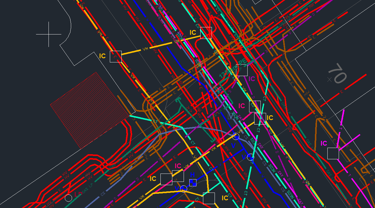
CAD Desktop Mapping provides a clear visual representation of all utility assets within the boundary of your work site, as identified in your utility search report.
Want to learn more about how we can turn your Utility Search into a comprehensive CAD utility map?
Convert your Groundwise Utility Report to a single, CAD format drawing, with our cost-effective Desktop Mapping service.
A Groundwise Utility Report will often contain hundreds of pages of maps, from various utility companies. This is where our Desktop Mapping service has proved to be so useful.
It’s a cost-effective addition to our Utility Search service and provides clients with a single DWG format compilation drawing – a digital, colour-coded design file.
All PDF utility search results are imported to CAD, and all hard features are fitted to the OS data tile. The utility records are then traced, and relevant information is added. The accuracy of the CAD file is the same as the PDF records provided by the asset owners.
Our Desktop Mapping service can be requested at any stage of your Utility Search project and quotes can be requested via email at: sales@groundwise.com
or Call Us
We get a lot of queries about our Desktop CAD Maps, so we’ve put together some answers to the most common questions.
A CAD desktop utility map from Groundwise is a comprehensive, colour coded map of all of the utilities within a specified area presented in an accessible CAD file (DWG file format).
It all starts with a utility search request. Once this is complete and we have received all utility search documentation from the relevant parties, we collate and compile all of the documents together. We layer each visual asset map atop one another to create a comprehensive overview of every known and reported asset within the specified radius. Our CAD designers then create the comprehensive file that shows everything all in one digestible format.
A Groundwise CAD utility map is beneficial because it affords a simple overview of all utility assets, along with filter options to hide irrelevant utilities or highlight the most important.
Hilltop SEND School Project location: Rotherham, South Yorkshire Client: The Great Yorkshire Build Sector/Industry: Private, Public & Third Sectors Project Information: A client...
View case studySolar Park Project location: North Scotland Sector/Industry: Renewable Energy Project Information: Our client instructed us to undertake a full Utility Search, for a site covering...
View case studyElectric Vehicle Charging Station Project location: Banbury, Oxfordshire Sector/Industry: Electric Vehicle Charging Network Project Information: Our client was at the planning stage...
View case studyNotifications